


Precinct 36, Elko County, Nevada
About
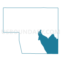
Outline

Summary
| Unique Area Identifier | 615305 |
| Name | Precinct 36 |
| County | Elko County |
| State | Nevada |
| Area (square miles) | 2,294.73 |
| Land Area (square miles) | 2,292.49 |
| Water Area (square miles) | 2.24 |
| % of Land Area | 99.90 |
| % of Water Area | 0.10 |
| Latitude of the Internal Point | 40.51912830 |
| Longtitude of the Internal Point | -114.47087780 |
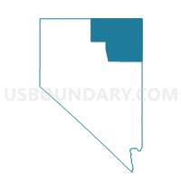
Maps

Graphs
Select a template below for downloading or customizing gragh for Precinct 36, Elko County, Nevada


Neighbors
Neighoring Voting District (by Name) Neighboring Voting District on the Map
- Ibapah Voting District, Tooele County, UT
- Precinct 18, Elko County, NV
- Precinct 20, Elko County, NV
- Precinct 21, Elko County, NV
- Precinct 34, Elko County, NV
- Precinct 35, Elko County, NV
- Precinct 37, Elko County, NV
- Wendover Voting District, Tooele County, UT
- WP COUNTY MAILING VTD 10, White Pine County, NV
Top 10 Neighboring County Subdivision (by Population) Neighboring County Subdivision on the Map
- West Wendover CCD, Elko County, NV (4,433)
- Dugway-Wendover CCD, Tooele County, UT (2,477)
- Wells CCD, Elko County, NV (2,059)
- Baker CCD, White Pine County, NV (363)
- Montello CCD, Elko County, NV (349)
Top 10 Neighboring Place (by Population) Neighboring Place on the Map
Top 10 Neighboring Unified School District (by Population) Neighboring Unified School District on the Map
- Tooele School District, UT (58,218)
- Elko County School District, NV (48,818)
- White Pine County School District, NV (10,030)
Top 10 Neighboring State Legislative District Lower Chamber (by Population) Neighboring State Legislative District Lower Chamber on the Map
- Assembly District 33, NV (51,407)
- Assembly District 35, NV (51,108)
- State House District 1, UT (34,122)
Top 10 Neighboring State Legislative District Upper Chamber (by Population) Neighboring State Legislative District Upper Chamber on the Map
Top 10 Neighboring 111th Congressional District (by Population) Neighboring 111th Congressional District on the Map
Top 10 Neighboring Census Tract (by Population) Neighboring Census Tract on the Map
- Census Tract 9515, Elko County, NV (4,782)
- Census Tract 1306, Tooele County, UT (2,477)
- Census Tract 9502, Elko County, NV (2,027)
- Census Tract 9701, White Pine County, NV (1,882)
Top 10 Neighboring 5-Digit ZIP Code Tabulation Area (by Population) Neighboring 5-Digit ZIP Code Tabulation Area on the Map
- 89301, NV (7,606)
- 89883, NV (4,488)
- 89835, NV (1,822)
- 84083, UT (1,516)
- 89823, NV (273)
- 89830, NV (270)
- 84034, UT (209)